Quarry face and landfill void space surveys in the North East
Measure faces, benches, stocks and void space without anyone near an edge. Drone surveys of quarries and landfill sites give detailed surfaces for volume calculations, face plans and sections, and repeat surveys on consistent control show how the site has changed.
Prefer to talk it through? Call 07970 393381.

What a quarry or landfill survey involves
The site is flown to a planned grid, with extra oblique passes along steep faces so the model captures them properly. Ground control and checkpoints measured with GNSS tie everything to the site's coordinate system.
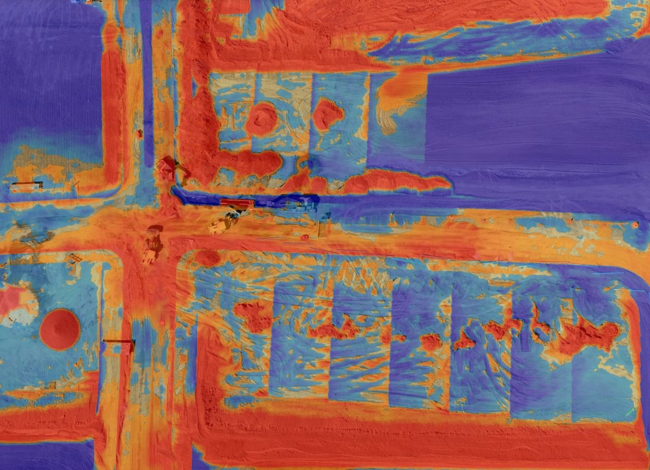
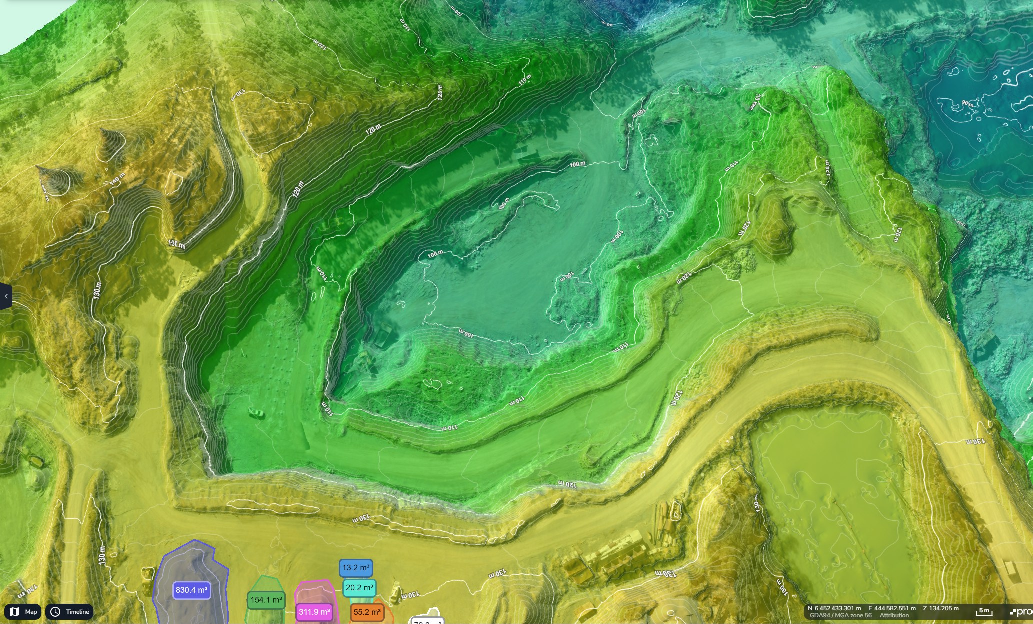
From the resulting surface, face positions, crest and toe lines, bench widths and stockpile volumes are measured. For landfill, the surveyed surface is compared with the permitted final levels or an earlier survey to calculate void space used and remaining.
What can be measured
- Face, crest and toe positions and bench widths
- Extraction volumes between surveys
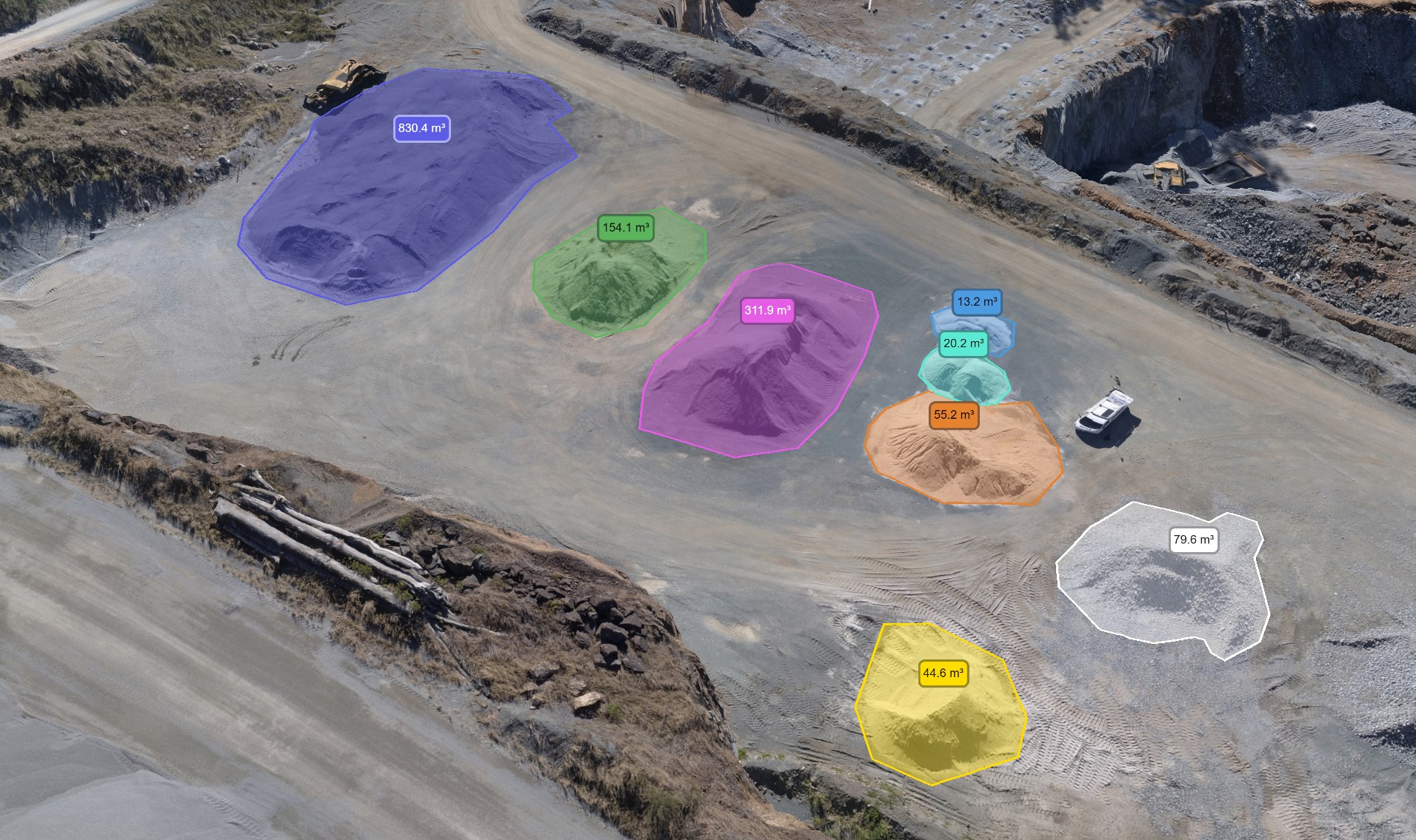
- Stockpile volumes for stock reconciliation
- Landfill void space used and remaining
- Haul roads, tip areas and restoration progress
What you receive
- Surface modelLandXML, GeoTIFF DSMThe surveyed ground for your own planning software
- Face planDWG, DXFCrest and toe lines, benches and contours, drafted by arrangement
- Volume reportPDF, CSVExtraction, stock or void space volumes against the chosen surface
- SectionsPDF, DWGCross sections through faces or cells at set intervals
- OrthomosaicGeoTIFFA dated, measurable image of the whole site
- Accuracy reportPDFCheckpoint residuals for this survey
Who uses these surveys
Quarry operators and managers
Face plans, extraction volumes and stock reconciliation.
Landfill operators
Void space tracking against permitted levels.
Mineral planning and environmental consultants
Measured surfaces and sections for reports and applications.
Restoration teams
Dated records of restoration progress.
How the work is done
- ScopeAreas to cover, surfaces to compare against, reporting dates and site rules.
- Site rulesAgree take-off points, site rules and exclusion zones with the site team, away from blasting and plant.
- ControlGround control and checkpoints measured with GNSS on the site's coordinate system.
- FlyGrid flights plus oblique passes along the faces.
- ReportSurfaces, face plans, volumes, sections and accuracy report.
How accurate are drone quarry and landfill surveys?
Each survey is flown with RTK positioning and controlled with ground control and independent checkpoints, and the accuracy report lists the residuals. Steep faces are captured with oblique imagery so they are modelled properly rather than smoothed over.
What affects the result
- Spread of control across benches and levels
- Oblique coverage of steep and overhanging faces
- Dust, water and plant on the day
- The surfaces chosen for volume comparison
Quarry and landfill questions
Can you fly while the quarry is working?
Yes. Flights are planned with the site manager around blasting, plant movements and other operations, following site rules and induction requirements.
How is void space calculated for landfill?
The surveyed surface is compared with the permitted final levels, or with an earlier survey, and the volume between them is reported as void space remaining or used.
Can you compare with our previous surveys?
Yes. Previous surfaces in LandXML, DWG or DXF on a known coordinate system can be used for comparison.
How often should a quarry be surveyed?
Many sites survey monthly or quarterly for stock reconciliation, and annually for face plans and reporting.
Can the survey cover stockpiles too?
Yes. Stockpile volumes can be measured from the same flight.
Stockpile surveys and volumetricsRelated services
All services